2013: Dunnet Head to Dalwhinnie

I started at Dunnet Head with the aim of walking the entire length of the route to Leathercote Point in one go.

After a preliminary leg along the watershed line from Duncansby Head (the main alternative end point in the neighbourhood), I started the route proper on 6th July 2013 at 11am.

7th July 2013

Camping on top of Stemster Hill; to my south-east, the sea, to my south-west, the first real hills, to my north, where I came from, and to the west, an endless expanse of flow country. 10 in the evening, and it's still light.

Some nice Scottish Wildlife Experience already - deer every day so far, seals before I reached Dunnet Head yesterday, at Ham and at Brough, a mole (I think) today and plenty of birds.

Me at the official start yesterday, at Dunnet Head

Me at the official start yesterday, at Dunnet Head.

8th July 2013

Feeling a bit tired and hungry this morning, and seemed to be going slowly… Things improved in the afternoon, though, and with Ben Alisky as my target for the day I pushed myself on. Finally ready to pitch camp at 9.30. Midges have been on-and-off today, interspersed with these bigger flies, I don't know, horse-flies and the like. Love the wilderness up here though, barely any buildings, nobody around, hills in the distance with huge areas of marsh in front. Picking my way through has sometimes been a challenge, but dry feet today…

9th July 2013

Today started nicely with sun and a breeze. The wind continued, so there have been no midges all day. Unfortunately it also brought cloud down, and with it drizzle… So not a lot of visibility crossing Knockfin Heights, but I nevertheless managed to negotiate it (it's a peat bog with multiple peaty ponds in, which you can't cross straight…) Crossed a practically unused A-road at Forsinard, and camping on a hillock for the night.

16th July 2013

Weather took a turn for the worse and gave me strong winds, mist and rain as I entered the mountains. Looking a bit brighter today, but the wind remains. So slower going than I would have liked, hoping to get to Ullapool as soon as possible because I'm hungry! Too much camp food… Mountains beautiful though, nobody much here either… Saw a few hikers at the weekend just before reaching the Crask Inn, no-one else.

17th July 2013

Today's route took me to my first munro of the route, Conival, and to a Corbett, Breabag. I suspect Conival in particular was a very nice mountain - not that I saw any of it, since I've been immersed in fog, rain and wind the whole day. Really nasty… Now found a not particularly great spot to camp, and everything's kind of damp… Sodden clothes awaiting me tomorrow, and probably the day after too. Would love it to be sunny tomorrow, or at least dry anyway… I can but hope.

20th July 2013

I'm on my first rest day in Ullapool. It's a rest from walking, but there are a lot of other things to do - buying food, fuel, gear, first aid stuff, and sorting things out while I have the opportunity of an internet connection on a PC.

I tried to fix the problems with the blog on the wiki. I haven't been using it properly… unfortunately there are a few broken links, and all the comments were deleted… but at least it may work better in the future.

Summary of the first two weeks

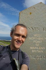
After lots of planning, but still many things left unprepared, I set off on the preliminary bonus day from Duncansby Head on the 5th July and then officially from Dunnet Head on the 6th. I initially felt quite intimidated at the scale of what I had committed to that lay ahead of me, but focusing only on the first resupply / rest day helped.

After a few days, it became clear I was setting a good pace, 28km per day or so, and I was quite optimistic. The bogs turned out easier than I had feared, perhaps drier due to good weather.

Then tiredness began to hit, along with pains from my rucksack straps among other things. I realised I had to ease off a little…

As I got into the mountains, the weather deteriorated, but I got into a reasonable rhythm, doing somewhere just over 15km per day. I felt the gradual depletion of energy, however, having weak legs and tiredness in the mornings. I began to feel hungry regularly, and longed to arrive at Ullapool to get some proper food.

Meeting Chris Townsend, doing the Scottish watershed in the other direction, on top of Beinn Leoid, was great, especially given the small number of hikers you generally see here - I think less than 10 on the whole trip so far.

I saw deer practically every day, frogs everywhere, a surprising number of lizards, fewer midges than I'd have expected due to the wind (though the cleggs were nasty…), and a few other interesting natural sights.

How easy is it to follow the watershed exactly, and how much trouble am I going to in order to go the right way? Well, it's not always easy to follow the correct ridges over every knoll and mound. I haven't been as dedicated to total correctness as I could have been - I've certainly tried to get to all the main tops, even minor ones, and to go the right way around lochans and so on, but there's a limit… I've often taking an easier path rather than follow the very top of every ridge, and have avoided small bumps and so on. Given the inherent uncertainty about the exact course, and the deviations which are inevitable due to unsafe terrain, forestry and land use and ao on, I feel this is acceptable. I try not to cut too many corners, to go the extra distance where there's a meander etc. Certainly the actual distance I walk is more than the distance shown on my map - what with bog-hopping, navigating peat hags, finding a route up steep slopes and the like.

Rain makes a mockery of the idea never to cross running water - every stone, every tussock of grass has water running off it. And I, myself, am a watershed, shedding water from every hair, item of clothing and part of my backpack…

A hot and sunny weekend in Ullapool has helped dry things out after the miserable weather on the Conival / Breabag day, and I've managed to do and buy everything I need, I think. Spirits revived and stomach filled…

Still an immense amount of the route ahead, but I think I'm at least ready for the next week on to Kinlochewe.

23rd July 2013

Top day's hiking yesterday, four munros from Seana Bhraigh through to Beinn Dearg, plus a few subsidiary hills. I camped right on the summit of Beinn Dearg, so this morning I'm starting high… Looks another decent day today, the wind has died completely overnight. One day out of Ullapool is of course when I find that a few things need replacing or mending… But nothing critical, I'll be able to make do.

26th July 2013

Finally some sort of internet connection… Camping on top of another hill, after resupplying at Kinlochewe this morning.

Thunderstorm as I set off up the road, and a heavy shower later on - the ground everywhere is sodden.

Had a few good days in the Fannichs, though, did the stretch to Kinlochewe faster than I had expected. So I revised my estimates, and hope to get through to the Great Glen without needing to stop at Shiel Bridge. This does mean a heavy bag, though. And bad weather could slow me down.

1st August 2013

Slowed down, mainly by poor weather for the past few days since Kinlochewe. Made it through to Glen Shiel yesterday evening. Looks like a really wet day today… contemplating a rest day. The north ridge to Sgurr a' Bhealaich Dheirg was quite something though… A sharp ridge. Concealed by the cloud, but still quite a walk / scramble. Cloud lifted as I approached Glen Shiel, so a good view in the evening. It's quite a place, steep sides and dramatic ridges reaching down from the summits.

8th August 2013

Made it through the Rough Bounds, and “turned the corner” - now heading east towards the Great Glen. Not even crossed a road for 4 days, so a bit of civilisation will be welcome.

Weather's been changeable, but the ground is really sodden, resulting in wet feet every day - neither pleasant nor good for lots of mileage. Am several days behind the estimates I made at Kinlochewe…

Stayed at Kinbreack bothy last night. Two friendly couples were also staying there, from whom I gladly scrounged spare food… (Looking forward to stocking up soon.) They, like most of the other people I've talked to about it, seemed very interested in my watershed walk.

South Glen Shiel ridge very impressive… Decent views to start with before the rain set in. Didn't move from my tent the next day, the weather was so poor.

Hard work walking in the Rough Bounds, but it's an amazing place, as rough as its name suggests in terms of terrain, contours and remoteness.

Camping high on Geal Charn now, just had breakfast and about to pack up and make a move. A few tough hills to come, even though I've now done all the Munros on the watershed north of the Great Glen.

Summary: Ullapool to the Great Glen

I arrived at the Great Glen on the 8th August. This is a bit of a milestone. While I haven't yet quite done quarter of the distance, I reckon I've exerted at least quarter of the total amount of effort. I've done 3/5 of the Munros, and over half the Corbetts, so from here there should be a bit less climbing. I've gone through the Rough Bounds and had some of the harsh weather of the North-West Highlands. This afternoon I'll set out on the last really long stage without resupply - I hope I'll reach Tyndrum in 10 days, but it could be 12 or more.

Setting out from Ullapool, I had some great weather, and enjoyed some fantastic hiking over Seana Bhraigh and the mountains immediately after. I arrived in Kinlochewe in fewer days than I expected. Sadly the good weather didn't last out, and I subsequently had two weeks where it rained at least a little every day. The ground was waterlogged and so I spent many days walking permanently wet boots and socks.

The going was tough - in places very tough, so I sometimes only managed 12km in a full day. Ridges full of ups and downs to negotiate and some awkward crags; tussocky grass, hard to step through and wet and slippery to descend; moss which sinks under every footstep; and occasional thick heather or bracken.

Nevertheless, these are some great mountains. The Fannichs were lovely, Kintail remote and desolate, the Rough Bounds memorably wild and rocky. They're not very popular - I saw a few hikers on the Fannichs, and some on the south Glen Shiel Ridge, but few elsewhere. Deer, grouse and frogs are the most common creatures around.

I grew ever more hungry. Kinlochewe and the Cluanie Inn made good stopping points, where I ate lots and lots to refuel. I managed to stay reasonably fit and healthy however - with the exception of one toe rubbing against another one, my feet are in good shape. My legs often ache in the mornings, but not excessively, and other complaints are similarly minor.

I feel like I'm putting off leaving today… although it really should be a rest day, it's not yet raining like the forecast said it would. Worrying about the weight of my bag when I finally come to leave. I've still a bunch of food to eat through first, after already eating a self-made fried breakfast and plenty of other stuff.

So - I'm steadily working my way through the high mountains. I have to say I'm looking forward to reaching the end of the area where phone reception is mostly non-existent, accommodation rare and shops even less common. The wilderness is awesome, but the logistics prove quite a struggle. But there are some interesting locations to look forward to over the next couple of weeks first, Stob Poite Coire Ardair, Ben Alder and the Black Mount among the high summits.

12th August 2013

It's been a satisfying day's walking today, though it isn't over yet. Despite the intermittent showers and on-and-off strong wind, the Stob Poite Coire Ardair ridge has made for good hiking.

Currently taking a short break on the sheltered side of the ridge, overlooking Kinloch Laggan.

Left the Great Glen two days ago in the evening, camping not far above the forest.

Yesterday it rained for hours and hours, but I still managed most of the distance I intended.

Profuse bilberries on the lower slopes have been very tasty over the last few days. I've also found a few very sporadic cloudberries, which are extremely yummy!

A setback

Progress was good over a few days, and now suddenly I've hit a problem. I've hurt, maybe sprained a muscle in, my left knee. At first it ached a little on the back inside, then within a day, started stinging at the front whenever I bent it. There's no way I can continue until it's recovered. So after a day's rest camped near Ben Alder Lodge I made my way down to Dalwhinnie for some further rest days.

Update - 22nd August

My knee is getting better, but very slowly. Having visited the doctor at Laggan Bridge (himself a walker who knew something about the watershed of Scotland), I am now resting for a further few days to see whether progress is sufficient to allow me to continue. If it's not possible to hike by next week, I'll be looking at curtailing the walk and continuing at some date in the future… But I'm still hoping that won't be the case. Now staying in Newtonmore.

A long-overdue status post

I realise I should have written this much earlier; the disappointment of having to stop walking prompted me to procrastinate and avoid making this unfortunate announcement.

After several weeks in Dalwhinnie and then Newtonmore seeing only very slow improvements, I decided to prematurely end the walk where I got to, close to Ben Alder Lodge. Returning home, I had a series of sessions of physiotherapy over four weeks, which seemed to identify the actual injury, if not the exact cause, and go a long way to healing it. It eventually took until early November for my knee to stop hurting, practically three months after it first happened. So I am at least confident I made the right decision: walking on further would have only made it worse, and I don't think there's any chance I'd have been able to complete another three months.

However, the watershed route still remains to be walked. Realistically, I don't plan to attempt the entire route again, and have to repeat what I've done already; instead I intend to continue walking the remaining distance in a number of stages over coming years.

In the meantime, I have been and will be travelling (and hiking) elsewhere in the world. If all goes to plan, I'll be returning to carry on up Ben Alder and initially on at least as far as Tyndrum sometime in 2015. I'll keep this page alive and update it with further plans.

If you're interested in hearing about it next time I update, then you can either follow the RSS/Atom feed (see the link above) or email me any time (david.r.edgar@gmail.com) and I'll keep you informed as and when I've something more to say.